Monday, June 30, 2014

Chicken, AK 6/30/14

Day 59 of our summer trip.

You may have noticed that I have been very sporadic with my posts and that they look different sometimes.  That is because we have been having sporadic internet and cell coverage since we have been farther north.  I was behind before, so that made for inconsistency, but even though we have stayed where there was internet service, the carrier is so slow that it can’t handle as much information as the blog requires to be posted.  We can barely get the e-mail sometimes.  There is no cell service in Chicken and the free internet that I was looking forward to so I could do some posting to the blog, just isn’t working that well.  I am looking forward to getting into the more populated areas so that, hopefully, I can update the blog.  The other thing is that I am using Windows Live Writer to work offline and it has a slightly different way it displays things from if I work directly with Blogger.  I think I am getting it figured out so that I can write my blog offline then upload it as a draft to blogger, check it out, and publish it.  Now if I can just get a faster internet connection, there may be some more posts for you to read.  They may come out of order with some back dated to when they actually occurred, but I hope to get them done eventually.  Now for today’s post. 

Today has been very cloudy and the rain has been variable in intensity.  We had some things to do now that we are back in the USA.  For instance, we needed to rearrange our money – put away the loonies and twonies ($1 and $2 coins) and other Canadian money and get out our American money).  We had to make sure all of our time pieces had been set back another hour to Alaska time.  There were some things that got jostled around that needed to be put back, repaired or cleaned up.  We had mail to be mailed in the US.  The rain let up enough to let us go sightseeing here in Chicken, in between storms, so let me show you around.

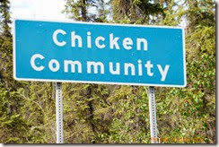
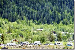
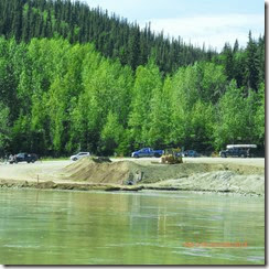
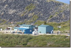
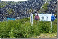
Chicken is not a town, village, or city. It is a community.  When we came down the hill, yesterday, this is what we saw.  First was the sign  then, at the bottom of the hill, was all of this mining equipment with more signs.
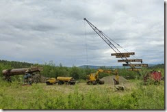
This is our introduction to Chicken, AK.  It is what we saw when we came down the hill into the community.P1040866

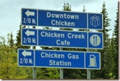
So today we went out to see what there was in Chicken.  The way the name came about was that the early miners had wanted to name it Ptarmigan, which is a bird that they had found to be prevalent in the area and that they thought was quite tasty.  Unfortunately, no one knew how to spell it so they settled for Chicken.  If you are into chicken décor, this is the place for you.  There is chicken themed everything here.  In fact, right here on the grounds of this campground, there is the mascot for the town.  Also, the mile post in the photos has some very creative destinations.  You can enlarge the picture to read some of them.  Bumble, the bee, said, “That’s one BIG chicken.”
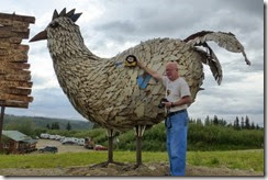
Bumble says, "That's one big chicken!"The official Chicken, AK chicken and mile post.

Here is “Beautiful Downtown Chicken” . 
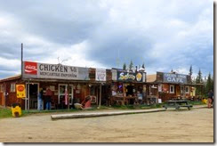
Beautiful downtow ChickenThat way to Chicken, AK

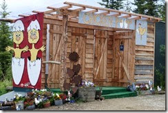
This is the “Chicken Poop” (out house) next to the shops in downtown Chicken..  The second photo is of another restaurant located near another campground.  I think the chicken signs are cute.
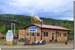
Cute saying on egg sign.  Also, chickens pulling a dog sled.Chicken, AK outhouse

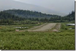
Chicken even has an airport.
Chicken Airport

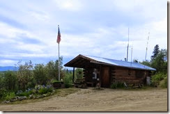
Here is the Post Office, from a distance and close up.  One lady, the postmaster, is there every M-F.  She is one of the very few people who live here year round.  The main road is closed in winter, so most people in Chicken are seasonal and leave before they are snowed in.
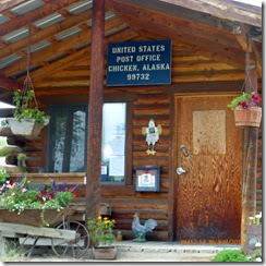
Chicken, AK Post OfficeChicken, AK Post Office


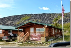
This is the sign for the campground that we are staying in.  It is a real gold camp and, for $10, people can pan for gold for 4 hours, using pay dirt that has been dug from the property.  We did not do it, but we saw that some folks were having luck.

 You can see them panning in the troughs below the dredge.

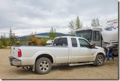
The Pedro Gold Dredge No. 4, that was used to dredge the Chicken Creek from 1959 to 1967, can be seen from our trailer, just above the tail lights of the truck.  It had been dredging the Pedro River near Fairbanks, AK before that.  Now it is on the National Register of Historic Places.
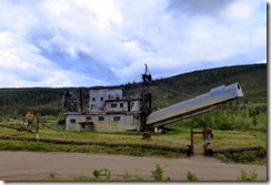
This is Pedro Dredge No. 4 In our Chicken Gold Camp and OutpostThis actually is a gold camp.  The Pedro Dredge No. 4 is the gray machine that looks like it has a steeple, above the tail lights

Now you have had a tour of Chicken, AK.

Sunday, June 29, 2014

Dawson City, YT to Chicken, AK 6/29/14

Day 58 of our summer trip, Top of the World Highway and Taylor Highway

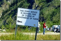
We went into Alaska today.  It was quite an adventure!!!  After we got packed up, we headed to the George Black Ferry in Dawson City.  It is the only way to get across the Yukon River and onto the Top of the World Highway.  The Yukon Government provides the ferry crossing free of charge, and from what we witnessed,  it really gets a workout. 

We had been down to the ferry last night to see how it worked, so we would know where to go today when we needed to cross the river.  We took some photos then because we probably wouldn't be able to take the same type of pictures when we were actually in the process of being transported, ourselves.  This is the information sign   People lined up according to what type of vehicle they were taking onto the ferry.  The ferry also takes motorcycles, bikes and pedestrians.
Line up for the FerryP1040772

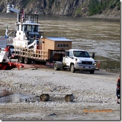
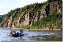
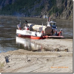
We watched for awhile, to see what actually happened with the loading and unloading of the  ferry.  Here, the ferry is coming in for a landing.  Once the ramp is safely down on the gravel, vehicles start driving off.  There are all sorts of things being transported across the river.
UnloadingHere comes the ferry


Now there is a method to this that only the ferry personnel know.  The vehicles are picked from the three lines that you see above, and arranged so that the load is somewhat balanced, then unloaded in a way that no one crashes into anyone else.  I think that there were only two small trucks or cars on the load with the double tank truck.  He was about the largest vehicle that would fit.
Ready to go

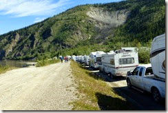
Now, it is today and we are in line for our turn to cross the Yukon River.  We are the last one in this row, so far.  That is a levee, next to us, that some folks are walking on and watching the action while they wait for their turn to get on the ferry.  It sure is a lot busier that last evening.
Here we are, waiting, at the back of the line, for the ferry.Yes, the sign is crooked

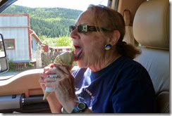
Some of the people were eating ice cream cones, while they were waiting, which gave us an idea.   We knew we would be waiting for awhile, so I volunteered to walk back to the ice cream shop and bring back a couple cones for us.  It would be our lunch.  The sun was shining and warm,   The shop was nice enough to let me have a dish to carry the cones upside down in, so it wouldn’t drip all over while I was walking back to the ferry.  I made it back, but we had to eat quickly.  The ice cream was starting to melt fast.  The cones were very good, mint chocolate chip and maple walnut.  We finished with plenty of time to spare before we left.
Ready to eatYummy, melting fast

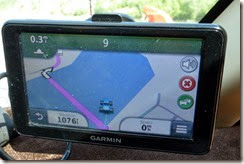
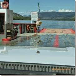
Flash forward  to the present (after an almost 2 1/2 hr. wait) and it is finally our turn.  Here we are getting on board.  The GPS has us in the water.  I guess it doesn’t know we are on the ferry.
I guess we can drive on waterHere we go

We will be landing on the flat spot to the left.  You can see the line up for the return trip.  Notice, there are not nearly as many waiting to go into Dawson City when compared to those that we left behind waiting for their turn to get on the ferry (in the photo to the right).
Those are the ones waiting to follow usThe other side of the river.  Line to go to Dawson City

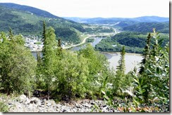
The road almost immediately went up hill to this view point, looking back at Dawson City, YT.  The town is at the left.  The river coming down the middle is the Klondike River and it is joining the Yukon River, which comes from the left and is the lighter of the two colors.  Weird how you can see the two different rivers, then they mix and become one.
Dawson City from the other side of the river

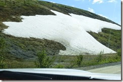
We are officially on the Top of the World Highway.  It is closed during the winter because it is so high (all of just over 4500 ft. at the highest), but this far north means it gets a lot of snow.  There are still piles of snow along the roadside in some areas.
There's still snow in spots here  Elevation 3700+ feetWinding dirt road

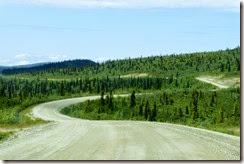
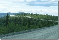
If you enlarge this photo by clicking on it, you will be able to see why it is called the Top of the World highway.  It runs along the ridge tops and connects with some blasted out roadway so that it is more level.   It goes way off in the distance.  Sometimes, there are drop offs on each side of the two lane road .  There are no guard rails.  It is a dirt and gravel road that has a lot of pot holes and is very dusty, since it was not raining while we were on it.  It would be muddy and slippery, if it was raining.  It is recommended to just stop and wait for the rain to pass, if it starts while you are out on the road, because it can become so slippery and dangerous.  There were a lot of spots that were in decent shape, but when it got rough, it was hard to try missing the bumps.  Every now and then there were short stretches of asphalt, but even that had holes and bumps. 
Road goes off to the left above tree line

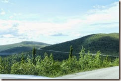
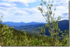
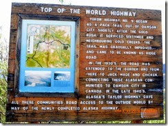
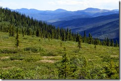
This is an explanation of the Top of the world Highway.  This sign was up just before the highest point on the highway.  Pictures just do not show the dramatic views that you can see in person, the deep valleys and the mountain tops, the variation in shades of color.  In this area, the tallest mountains are only in the 6000s of feet.  Nothing huge, but because they drop all the way to the valley floor without many foothills, they seem so much bigger.
It's hard to get the emencness of tthe sceneryP1040823

This is a different and closer view of the same mountain range.
Top of the world highway

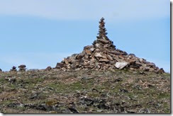
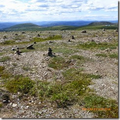
The next stop was a view point at the highest point on the Top of the World Highway, 4,515 ft.  Many people have piled rocks over the land when they passed by here.  Someone even made a tower on the hill across from the parking lot for the pull out.
Some folks have piled rocks on a hill at the side of the highwayThis is the highest point on the Top of the World Highway

We are almost in Alaska, now.  That is it down below, as seen from the same area as the previous photos were taken.  On the Canadian side is the Little Gold Creek Customs and on the U.S. side is the Poker Creek Customs.  And, guess what?  There is construction going  on on the U.S. side of the highway.  They are nice enough to work at night, when the border is closed anyway.  That helps us in that there is no huge equipment to contend with, but boy!, they have some really coarse gravel  spread out for a long way.  They are working on 13 miles of road.

Construction done at night.  The border is closed at nightThere is the border station for Yukon, Canada and Alaska, U.S.A.

Here we go through the check point.  The sign states that Canada and the US are working together.  We did not have any trouble getting past the customs agent and we were on our way, now in the good ole U.S.A.

Officially in AlaskaWe'll be next

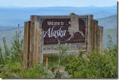
Here are the welcome signs, the one at the U.S. Border check point and the one at a view point.
P1040849And here we are

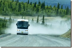
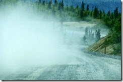
Now, we are on the American side of the road and it is called the Boundary Spur Road.  Remember I said we were going to have 13 miles of construction.  Well here it is.  You can see if someone is coming by the dust flaring up behind them.  Someone is coming down the hill, on the upper left side.  Oh, it is a bus, a very big bus.
CloserHere comes the dust

And, there he goes…  We had to stop to let the dust settle before we could see well enough to drive on.  Needless to say, we had some major dirt added to our collection.  We really need to wash our vehicles!
There he goes

Eventually we made it to Chicken, AK.  It took about 5 hours to drive the road between Dawson City and Chicken, all 109 miles of it.  We stopped to take pictures a few times, but other than that, it was a very slow ride because of the condition of the road.  We had some things shaken up and messed up and spilled out of drawers. but it was all OK in the end.  WHAT AN EXPERIENCE!, ONCE IN A LIFETIME!


Saturday, June 28, 2014

Dawson City, YT 6/28/14

Day 57 of our summer trip.

Today, I think I will do the blog a little differently.  We saw some interesting things that I would like to include several photos of, so I may not have as much narrative,  If you hover over the picture, I believe you will get an explanation of what we saw.

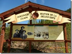
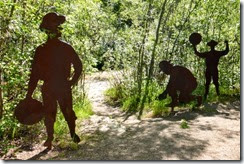
Our first destination for today was to go into the Discovery Site where gold was first found on the Bonanza Creek here in Dawson City.  The road to that area is right next to our campground, the Bonanza Gold Motel and RV Park.   The Discovery Claim has an interpretive trail with many things to see and signs to explaining all of the happenings surrounding gold discovery in this area.
Some characters along the interpretive trail of the Discovery ClaimDiscovery Gold Claim on the Bonanza Creek in Dawson City, YT in 1896


Some of the old tailing piles from the dredgesWe found it here.  The river is just down the small trail


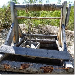
Material was hauled up from belowAn old mine


Old rocker box for classifying the material and hopefully find the goldThis guy is slucing, the old fashioned way


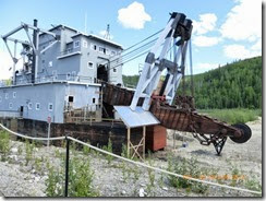
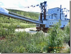
Next, we visited the largest of the Bonanza Gold Dredges, No. 4.
Dredge No. 4 The buckets would be attached to this end and would dig into the river bed to hopefully get to the goldDredge line buckets


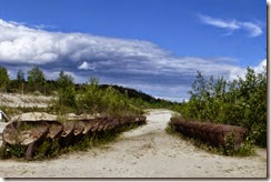
Some of the old tailing piles from the dredgesDredge No. 4 rocks would be discarded through this shoot into the tailing pile

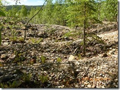
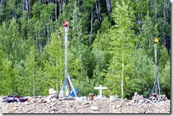
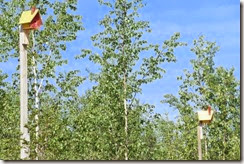
We kept seeing bird houses along bonanza Creek Road.  They would be on the old tailing piles and all of them looked extremely similar.  It must have been the same person or group of people who installed them because they were all mounted the same way.  Why they are all (maybe 50 or so along the length of the road)  there, we could not tell, except to keep the birds happy.  Here is a sample.  The second set is actually a memorial to someone.  From the body of a ATV that is crushed and beside the other tributes, I would guess that the person who died was killed in an ATV accident.
P1040734Bird houses along the Bonanza Creek Road

This is the top of Midnight Dome, from a distance, where we went yesterday.  You can see that there is nothing around to block our view of the sun.
This is the top of Midnight Dome

We took a hike to a viewpoint where a geocache was hidden.  We found the geocache and the view was great!  This is the trail and the view at the end.
The confluence of the Klondike River (dark brown) and the Yukon River (light brown) in Dawson City, YTThe trail to Crocus Bluff View Point

I told you that they were continually scraping the dirt roads in town.  Well, on our back from the viewpoint, here came the road graters.
The road graters are coming

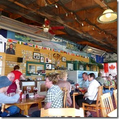
We went back to the trailer for awhile.  I worked on the blogs and Earl did some chores around the truck and the trailer.  We went out to dinner at Sourdough Joe’s and had a delicious fish and chips and seafood chowder meal.  We highly recommend this restaurant.
Dinner at Sourdough Joe'sSourdough Joe's .  We sat right insid the window to the right of the picture


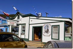
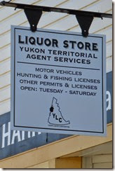
After dinner, we went exploring a little more.  This is one of the restored buildings.  I like the fact that you can get a lot done at this one stop shop.
Close up of signIt has a little bit of everthing


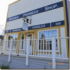
Two photos of Front street.
Street scene along Fron StreetInteresting cabin on Front Street

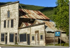
These old buildings have been purposefully left like they are to show visitors what happens when you build on permafrost and the heat from the building melts the permafrost, causing the footings to settle at different rates.
1901 building affected by permafrostBuildings from 1901 a

Tomorrow we will be entering Alaska.  We’ll see what adventures that brings.