Saturday, May 10, 2014

Travel to Escapade, 5/9/14

Day 7 - Friday, May 9, 2014
Iowa, Illinois, and Indiana

I did not write a post yesterday because it was a very bad day, so I am writing about yesterday.  It started out OK.  We continued to travel through Iowa.  The farms were scattered across the rolling hills.  Fields had been planted, but have not come up yet.  There are some green pastures with cows and sheep and interesting barns.


We crossed the Mississippi River at Davenport, Iowa.  Here is what the approach looked like. 

The view up river toward Davenport, Iowa

                                      Looking down river.  Still very rustic in that direction.

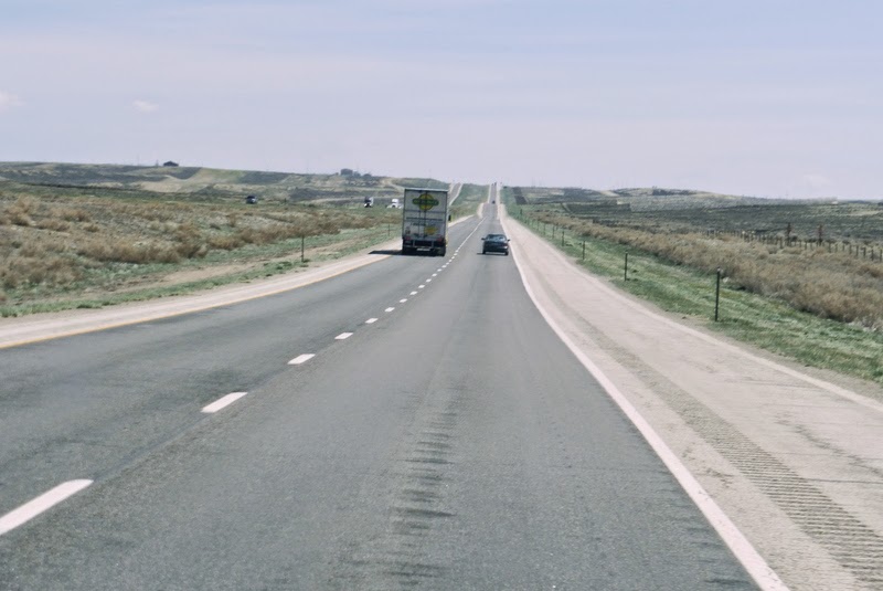
The other side of the river is Illinois.  We drove through Illinois and discovered that they have some of the worst roads we have been on yet.  They have a portion of I-80 that is a toll road that isn't any better than their non-toll portion.  This is one of the toll entrances, on the right.

The Illinois toll road has bridges across the highway.  They are rest areas used by both directions of  traffic.  We have been to rest areas that are shared by all traffic, but usually they are located off the highway and you drive to them.  These, you pull off to a parking area, like at most rest areas, but you walk in and up to the bridge where all services are located.  Of course, there are more services here, since you are on the toll road and ordinarily don't get off until you reach your destination
 
Now, things took a turn for the worse.  Like I said, Illinois has some of the worst interstate roads that we have been on this far, in the last week, since we left home.  We thought California had bad roads, but these top them in disrepair.  The pot holes are like craters and you can't avoid them.  Traffic is so heavy that you can't slow down because most everyone else is going at least the speed limit and you would be creamed.  You can't shift sideways to miss them, either, especially with a 1 ton pick-up pulling a 35 foot fifth-wheel trailer.  So, you hit them.  There were people off to the side of the road changing tires in groups of two and three.  Apparently, this is and has been quite a problem for some time.  The news that night, Friday, had a segment on the bad roads and how people wanted the government to take responsibility for damage done to their cars.  We were feeling pretty lucky that we weren't among that group with flat tires or a broken spring, after our experience on the drive through Illinois on I-80. 

When we took a break from driving and went inside the trailer, things were tossed around so much that somehow, either by being bumped by another object or just twisting and bouncing, the glass front to our electric fireplace was shattered.  Thank goodness it was safety glass and turned into little pieces not shards of glass.  Also, it still worked, which is nice.  We had secured the cabinet doors, in prep for our travel to Alaska later in our summer adventure, so nothing had fallen out of the cabinets.  Could the roads in Alaska be worse than what we had just experienced???!!!

That wasn't all.  Once we found the campground for the night, we barely made it into the site as the truck was beginning to skid on the mud as Earl was backing in.  To make things even worse, the leveling system for the jacks decided to be totally out of sync, causing it to say we were at a severe angle even though we were almost level.  It wouldn't let us move the jacks up or down.  We gave up trying and continued to finish hooking up the trailer.  Wouldn't you know it.  The electricity didn't work at the post for our site.  We ended up running an extension to the site next to ours.  Totally frustrated, we went into the trailer to get dinner, clean up the broken glass and prepare for going into the Escapade rally on Saturday, provided we could figure out what to do with the jacks to get them to retract and that we did not get stuck in the mud as we left the site.

We have eaten dinner, cleaned the trailer, and are going to bed and are hoping for a better day tomorrow.


Thursday, May 8, 2014

Travel to Escapade, 5/8/14

Day 6 - Thursday, May 8, 2014
Nebraska to Iowa

Today started very early with an appointment at the Crossroads Ford service department in Kearney, Nebraska.  Our truck told us it needed an oil change and they were nice enough to accommodate us as we traveled through the area.  After the service was completed, we went back to camp and packed up to continue our travel to Indiana.  As we left Kearney, NE, we passed under the Great Platte River Road Archway Monument.

We finished crossing Nebraska and are now in Iowa.  Today was the first day that we had to drive in the rain.  The rain was very heavy, but not dangerously so.  Now that we are in camp for the night, the wind is strong and there is heavy rain again, but we are assured that the bad storms are staying away from this area.

Although Nebraska and Iowa have beautiful farm land and rolling hills, I did not take any photos.  This part of the country is much more populated so traffic was heavier and needed more concentration.  One thing that is different in this area and much of the eastern part of the country is that entrance onto the freeway is a "Yield" not a "Merge" like we have in California.  You really have to be careful because, often, the drivers on the freeway do not slow down or scoot over for you if you are coming onto the freeway. 

That's it for today.  We'll see what tomorrow brings.

Wednesday, May 7, 2014

Travel to Escapade, 5/7/14

Day 5 - Wednesday, May 7, 2014
Nebraska

Last evening we were treated to a light show.  California doesn't get lightening very often, so  it was very exciting and interesting to watch the lightening jump from cloud to cloud in the distance.  We were far enough away from the actual storm that we had stars above us and we could not hear the thunder from the lightening that we saw.  However, during the night, we were awakened by the thunder and rain hitting our trailer.  That was all gone by the time the sun came up.

Agriculture is definitely one of the main occupations in Nebraska.  The highway passed fields that have been recently planted or are just beginning to grow and several that have not been worked yet.  There was a lot of pasture land with cows, sheep and goats being the most seen animals.  Spring is just beginning in this area.  The leaves on the trees are just starting to emerge.  Even the spring landscaping is yet to be done in many places, for example,  around the sign below.

Traveling along I-80, you come to this huge arch across the highway at Kearney, Nebraska.  Over the years, we have passed by this arch and wondered what it was about.  It is the Great Platte River Road Archway Monument.  We did not go inside this time, but did a few years ago.  If you ever get a chance, stop by this attraction.  There is an amazing museum inside that covers the time from wagon trains heading out to explore the west and progresses through modern times.  It is very well done. 
 There is also a small fort that contains a maze inside and "guard towers" on each corner.
The entrance to the archway is behind the fort.  As you enter, you are guided to an escalator that takes you up to the arch that crosses the freeway.  The museum winds around in the arch and comes to an area that you can look out at the traffic flying by beneath you.

The reason that we are staying in Kearney, tonight, is because we need to have the oil changed in our truck.  Our new truck is so computerized that it tells us when we need to get service and what it needs.  So early tomorrow morning, we will be taking the truck to the local Ford dealer for a service appointment.  Therefore, I better cut this post short and get some sleep. 


Tuesday, May 6, 2014

Travel to Escapade, 5/6/14

Day 4 - Tuesday, May 6, 2014
Wyoming to Nebraska

It has been cloudy to partly cloudy everyday so far on our trip, but today, we woke to a bright sunny day.  It was cool, but not cold.  The view that we had out of the car window, as we continued across Wyoming, was of rolling hills, mountains in the distance and mostly ranch land, some oil wells and a few cities.

We did go up in elevation, but it was mostly by going up rolling hills.  There was very little long haul mountain driving.  We did see many, many snow fences used to keep the snow from drifting across the highway.  If you noticed, in the previous picture, there aren't many trees to stop the wind from blowing the snow. 
Just before we got to the highest point on the highway, we saw how the snow had drifted along the fence and has not melted yet.  As the wind blows across the prairie or field, the snow blows up against the fence which acts like a riffle causing lower pressure behind it   That causes the snow to be "sucked" down rather than continuing on across the highway or where ever.

There is the Summit rest area, which is located at the highest elevation on I-80.  The leaves still haven't come out on the trees, in the background, at the 8640 ft. altitude.

There is quite a display explaining the history of this area, at this rest area.  Mostly, ranching and farming are current occupations, but in the 1880's there was a lot of logging of the forests that used to be here.  The logs were used for housing and for building the railroad which was used to transport the livestock and crops to market.

Much of I-80 was built along the path of the Lincoln Highway.  The Lincoln Highway was the first transcontinental highway going from New York City to San Francisco.  It was completed in 1913 when automobiles were first becoming popular and affordable for families, who , of course, wanted to travel to see things that they had only heard about before.  In 1959, a monument of Abraham Lincoln was built and it is the only monument to Lincoln along the highway that was named for him.
Some stats of the monument are that it weighs 4500 lbs. and it is 13 1/2 feet tall.  That is the head only.  See it compared to the man in the picture below.  The monument was moved to this location in 1969 when I-80 was completed.
 

There is another monument dedicated to Henry Joy, who was the first president of the Lincoln Highway Association as well as president of the Packard Motor Car company.  He is often referred to as the father of the national highway system.


As we were walking back to the truck, we passed this little guy, a prairie dog.  He seemed very brave to stay out of his hole while we were only about 5 ft. away.  A crow flew by and that made him disappear.  It is so unfortunate that someone did not take care of their garbage and now the prairie dog has taken that plastic bag into his hole.
 
Tonight we are in Sidney, Nebraska at the Cabela's RV Park right next to the store.  Cabela's has outdoor supplies and sporting equipment.

Tomorrow we will continue across Nebraska.  It is a very wide state, so we may still be in Nebraska by the end of our driving day.


Travel to Escapade, 5/5/14

Day 3 - Monday, May 5, 2014
Utah to Wyoming

We continued traveling on I-80 into Utah.  The Bonneville Salt Flats are near the western entrance into Utah.  This is an amazing site.

The actual Bonneville Raceway is located far off the highway back closer to the mountains. We did not go there.  There is an observation area at the rest area near the beginning of the approximate 50 mile long section of the highway that passes through the salt flats.  Here is a photo of the salt flats taken from that observation tower.  All of the white area in front of the mountains is salt.
 This is our trailer at the rest area.  The salt is everywhere that is not covered with asphalt.
 
This gives you an idea of what that 50 +/- miles looked like.  Pretty boring and white, huh?
 
 
There were a couple things, to break the monotony, that you won't see anywhere else. 


How many times have you seen an 80 MPH speed limit?  The tree with Christmas balls on it are actually microwave and communication antennas in disguise. 

As we neared the eastern side of the salt flats, we saw several salt processing plants.  The salt is piled so high that it towers over trucks and buildings.  THAT'S A LOT OF SALT!!!

Next along our route was the Great Salt Lake.  It is difficult to see because we had a very cloudy day, so everything had a blue hew, and the road is just about level with the lake, but the bluish color at the base of the mountains is the salt water lake with some areas of salt where the water has evaporated along the shore.


There is a copper smelting company along the highway west of Salt Lake City.  It is so huge that it took two photos to show how big it is.  The stack in each picture is the same one, just to give you a perspective.


We do not like to take I-80 through Salt Lake City because there is a very long steep hill going out to the east.  Instead, we go around on the western side and north of the city to get to I-84 east then meet up with I-80 after that hill.  There was a rock formation along side of I-84 that was called Devil's Slide.  I think it looked like a child's slide only made of rock and very long.

Not far past this formation, on I-84, there was a dramatic change in the terrain.  First there were these outcroppings.  Then we went around a curve.
When we got around the curve, this is what we saw.  I can't even imagine what sort of earthquake or other force caused the mountain to be tipped on its side like this.

After we got back on I-80, we completed traversing Utah and entered Wyoming.  When we got into the Green River area, the terrain changed again.  Now we saw very definite layers of sediment which were white on the bottom and brown on top.

There were more tunnels to go through with many layers of rock above the tunnels. 
 Then, on the other side of the tunnel, we saw these formations.
 
Shortly after this, We arrived at our campsite for the night.  We will continue traveling tomorrow.


Monday, May 5, 2014

Travel to Escapade, 5/4/14

Day 2, Sunday, May 4, 2014
Nevada

This morning, when we stepped out of our trailer, we could see some traces of snow on the distant mountains.  Here you can see our campsite for last night.

We were driving through the high desert of Nevada and I thought it was so interesting to see how the mountains seemed to rise from nowhere, right out of the flat land.  Look closely at the top of this mountain.  (By the way, for anyone who may not know, if you click on any of the photos in my post, you will see a slide show of all of the photos in that post and they will be much larger.)

Here is what I discovered, when I was editing my photos from today.   It seems that there were some radar antennas as well as other antennas perched on top of the mountain.

 I liked the different shades of green that made a colorful design on this mountainside.

We had a tunnel to go through as we traversed Nevada on I-80.  There are actually four tunnels - one for each direction of the freeway and one for each direction of the railway. 

We entered the tunnel.

This is what was on the other side.  There was a lot of construction going on.  and the mountainside was interesting with its strips of brown and green.

I think this is the most snow coverage that we have seen so far on this trip.  Again, the mountains seem to come out of nowhere.

We are camped for the night.  Tomorrow is another travel day.  As we go into Utah right at the beginning of our drive, we will change to Mountain Daylight Time from Pacific Time.


Sunday, May 4, 2014

Travel to Escapade, 5/3/14

Day 1 - Saturday, May 3, 2014
California

We are embarking on our longest vacation ever, for us.  We left home today and traveled through the Sierra Nevada Mountains of California and into Nevada.  California has been in a severe drought for the past several years.  The snow pack, that we depend on to store water for summer use as it melts in the mountains and runs down rivers to supply water to the low lands and reservoirs, was only at 19 % of average for this time of year.  Some areas that they use every year to measure the snow pack and water content of that snow, had no snow at all. 
 As you can see, there is very little snow on these mountains near the town of Cisco Grove, CA.  As we continued on to the Donner Pass, high point on I-80 in CA, there was more snow, but usually it would be deeper than this and even deeper as we continued up in elevation. 

We stopped at the Donner Summit rest area and saw the following.
These castle peaks were across from where we parked in the rest area. 

This pond was the result of melting snow at the rest area.  Very beautiful anyway.  This was the deepest that we saw.

As we were heading further east on I-80, we notices a line on the mountain side.  It was the snow sheds that were built to protect the railroad tracks from all of the snow that would fall and tumble down onto the tracks.  The sheds formed a "tunnel" where the trains could have a chance to make safe passage and keep commerce flowing from coast to coast in the winter.

This is a close up of the snow sheds.  They run for miles and miles.

Here is Donner Lake. 
 
All of the "Donner" names are in tribute to the Donner Party, a group of pioneers, who were caught in an early snow storm in the winter of 1846-47.  Only 48 of the 87 people survived the winter in the mountains near here.
 
Here were some interesting cloud formations that we saw.  The sunset was not very colorful tonight.

That was the first day of travel.  Tomorrow we will continue along I-80 on our way to Indiana and the Escapees Escapade.